|
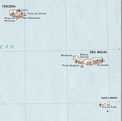
Santa Maria Azores MapThe Santa Maria Azores Map is a nice little tool that you can use to get an idea of the size of the island. It is a fairly small, measuring just 17 by 9.5 kilometers. Like many of the islands in the Azores, it is possible to drive around the island in just one day. But you will have a far better time if you stay for several days and explore the island at a more leisurely pace. This allows you to fully appreciate the island. This Santa Maria Azores Map is easy to use so you can explore the island. Simply use the tools on the upper left corner of the map to zoom in or out and to move up, down, left or right. Some notable areas of Santa Maria include:
Wondering where Santa Maria is? The island is closest to Sao Miguel Azores. The map shows where it is in relation to Sao Miguel at the most Southwestern tip of the archipelago: And to see a map of all of the islands, go to the Azores Map Read more about Santa Maria Acores or go to the Magical Azores Islands home page for lots of information about all of the Azores Islands. |


